Antarctica unmasked: a new look under the ice sheet
-

- Web Desk
- Jan 16, 2026
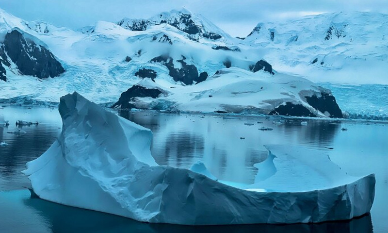
A new map offers most detailed view yet of Antarctica’s hidden landscape. Scientists have produced the most detailed map yet of the terrain buried beneath Antarctica’s vast ice sheet, revealing thousands of previously unknown hills, ridges and deep channels that could play a key role in how the continent responds to climate change.
The research, published in the journal Science and reported by the BBC, combines satellite observations with computer models that simulate how Antarctic ice flows over the land beneath it. By analysing subtle changes in the ice surface and its movement, researchers were able to infer the shape of the bedrock below, even where the ice is several kilometres thick.
Until now, much of Antarctica’s subglacial landscape had remained poorly understood. While satellites have long provided detailed images of the ice surface, traditional methods for mapping what lies beneath, such as radar surveys flown along narrow tracks, left large gaps between measurements.
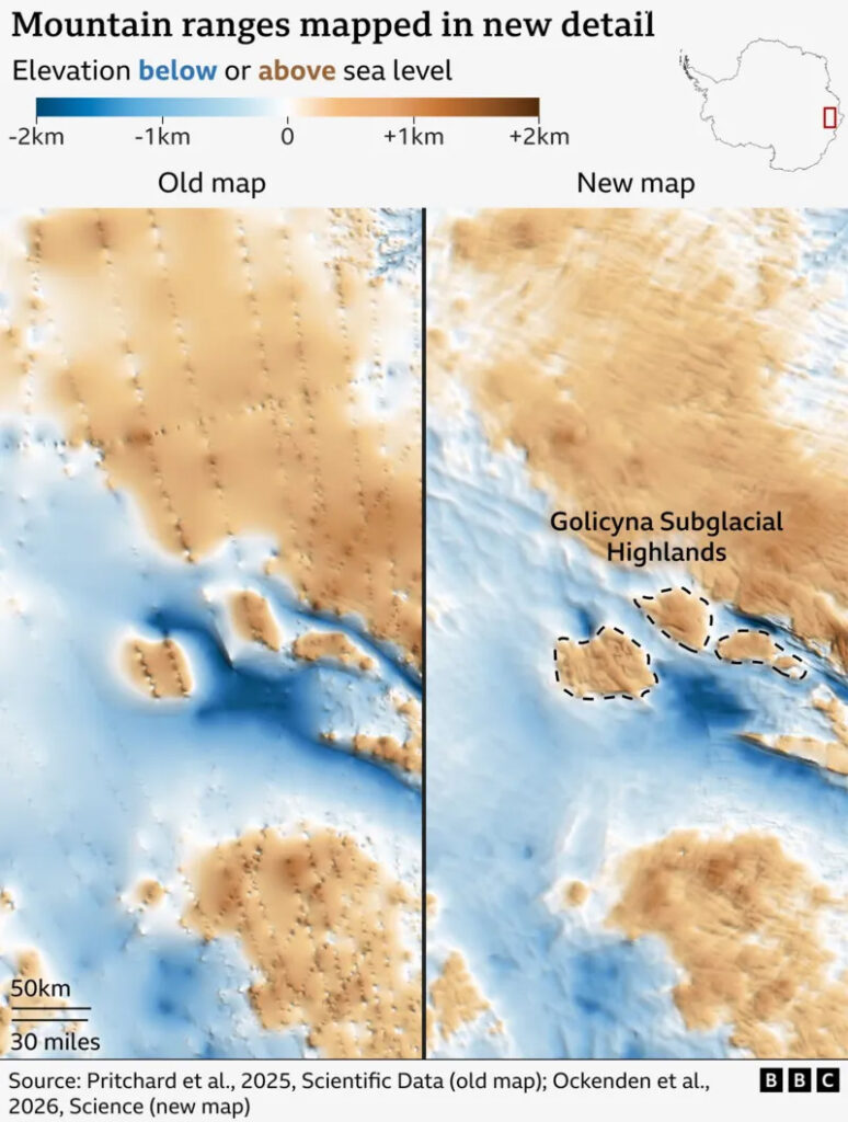
The new approach fills in many of those gaps, producing what researchers describe as a far clearer and more continuous picture of the continent’s hidden topography. According to the study’s authors, the map identifies tens of thousands of small landforms that had not been recognised before, as well as sharper detail in known mountain ranges and basins.
Lead author Dr Helen Ockenden of the University of Grenoble-Alpes said the advance is comparable to switching from a blurry image to a high-resolution digital photograph. Co-author Prof Robert Bingham of the University of Edinburgh said seeing the entire bed of Antarctica mapped in such detail was “amazing”.
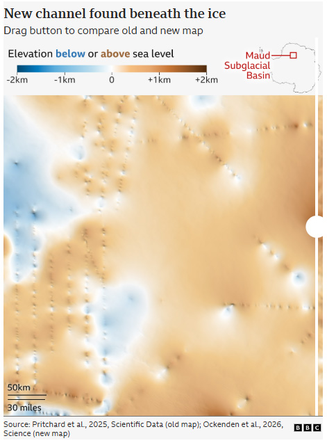
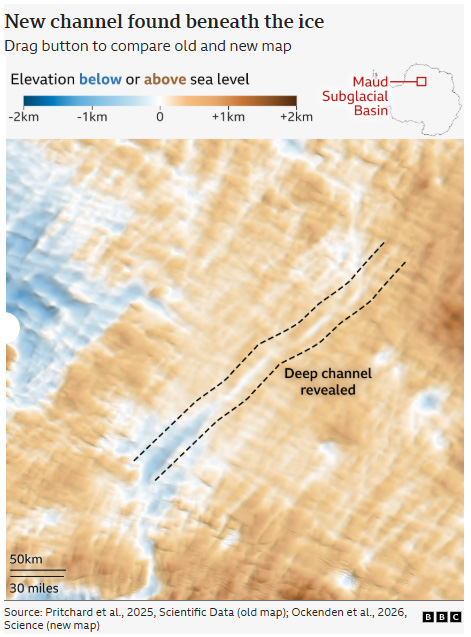
Among the notable findings is a long, deep channel carved into the bedrock of the Maud Subglacial Basin. The feature stretches for nearly 400 kilometres and is several kilometres wide, highlighting how dynamic the landscape beneath the ice can be.
Other scientists say the map represents a significant step forward. Dr Peter Fretwell of the British Antarctic Survey, who was not involved in the research, said it would help bridge the gaps between existing surveys and improve understanding of how glaciers interact with the land beneath them.
Researchers stress that the map is not definitive and still relies on assumptions about ice behaviour. Further data from ground, airborne and satellite surveys will be needed to refine it.
Even so, the improved picture of Antarctica’s hidden terrain could have important implications. Subglacial hills, ridges and channels influence how fast glaciers move and how they may retreat as the climate warms. Because Antarctica’s future rate of ice loss remains one of the largest uncertainties in climate science, the researchers say the new map could help improve projections of global sea-level rise.
You May Also Like