
- Web
- 13 Minutes ago
Horacio intensifies to 160 mph; becomes 2026’s first ‘Category 5’ storm
-

- Web Desk
- Feb 24, 2026
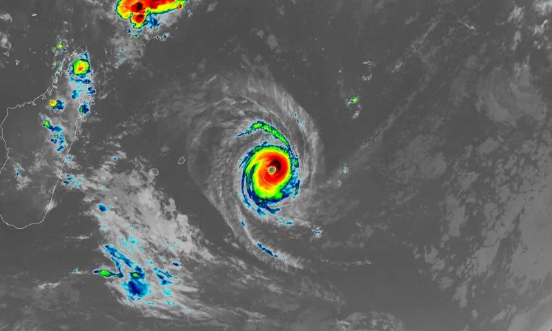
Tropical Cyclone Horacio has intensified into the first Category 5 storm of 2026, reaching peak strength Monday afternoon over the open waters of the South Indian Ocean.
According to forecasters, Horacio’s winds climbed to 160 mph (260 km/h) on February 23 as the powerful system churned east of Madagascar. Satellite imagery from NOAA and Colorado State University captured the storm at its height, showing a well-defined and formidable cyclone spinning far from any populated land.
The storm strengthened rapidly as it passed over warm ocean waters measuring between 27 and 28 degrees Celsius (81-82°F). Atmospheric conditions were also conducive for development, with only moderate wind shear allowing the cyclone to organise and intensify.
The US Navy’s Joint Typhoon Warning Center said Horacio has likely reached its maximum intensity. Forecasters expect the system to gradually weaken as it tracks southward into cooler waters and encounters stronger wind shear in the coming days. Because the storm remains over remote ocean waters, it poses no threat to land, though it could impact marine operations in the region.
Horacio marks the Southern Hemisphere’s first Category 5 cyclone since Cyclone Errol reached that level off northwestern Australia in April 2025. Historically, the planet averages just over five Category 5 storms per year, based on data from 1990 through 2025. Last year saw five such systems worldwide, including three in the Atlantic basin, one in the Northwest Pacific, and Errol in the South Indian Ocean.
Scientists have warned that as global temperatures rise, a greater share of tropical cyclones are expected to reach the most intense categories – Category 4 and 5 – even if the total number of storms does not necessarily increase.
You May Also Like