Cyclone Biparjoy likely to hit Keti Bandar on June 15
-

- Zafar Ali
- Jun 12, 2023
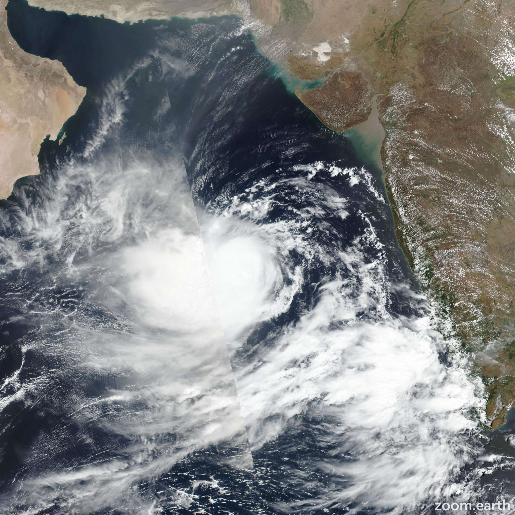
ISLAMABAD: The Pakistan Meteorological Department (PMD) has said that cyclone Biparjoy —, which is currently about 650 kilometres away from Karachi, 620-km from Thatta and 690-km from Ormara — is likely to hit Keti Bandar and the coast of the Indian state of Gujarat on June 15.
The Met Office said that the violent cyclonic storm is likely to move north and north-east by June 14.
The PMD has forecast rains in Thatta, Sajawal, Badin, Tharparkar and Umarkot from June 13 to June 17.
The PMD said that eight to 12 feet high waves are likely to rise during the storm in Keti Bandar. The PMD has advised fishermen to avoid venturing into the sea until June 17.
Meanwhile, the Karachi commissioner has issued orders to remove billboards and signboards from the main roads of the metropolitan city to avoid any mishap.
The PMD has asked the authorities concerned to be on high-alert following as the cyclone is moving towards the coastlines of Sinh.
Ina tweet, Minister for Climate Change Sherry Rehman said that there is no need to panic but caution and advised for better preparedness to cope with any possible eventuality.
Meanwhile, the PMD has predicted that most parts of the country will remain hot and humid during the next 12 hours.
The Met Office has predicted moderate to heavy rain in upper Punjab, Khyber Pakhtunkhwa, northeast Balochistan including in Barkhan, Qila Saifullah, Kalat, Khuzdar, Lasbela, Makran, Awran and Turbat.
The Met Office has forecast partly cloudy and windy weather in Mirpur Khas, Thatta, Badin and Mithi during the next 12 hours.
It has predicted rain in Dir, Chitral, Kuhistan, Kurram, Mansehra, Abbottabad, Peshawar, Kohat and Bannu, Waziristan, Dera Ismail Khan and surrounding areas.
The Met Office has also forecast rain in Gilgit-Baltistan and Azad Jammu and Kashmir.