
- Reuters
- October 21, 2026
El Niño could be strongest in 40 years, UN weather agency chief says
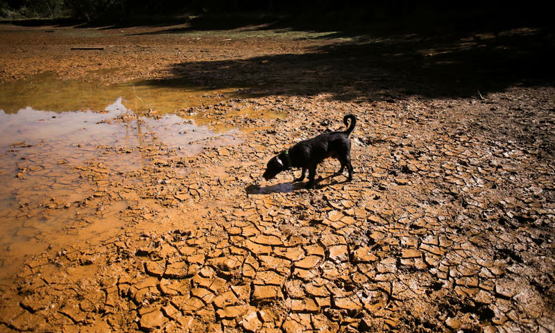
GENEVA: El Niño could reach unprecedented strength, exceeding anything observed in the past four decades, the head of the United Nations weather agency warned on Wednesday, raising concerns about extreme heat, droughts and flooding worldwide.
Celeste Saulo, secretary-general of the World Meteorological Organisation (WMO), said the developing climate phenomenon could bring intense heat and disrupt rainfall patterns, triggering severe drought in some regions and flooding in others.
The warning comes as Pakistan faces the prospect of extreme weather in 2027. The Space and Upper Atmosphere Research Commission (SUPARCO) had warned that the year could become the hottest on record both for Pakistan and globally, with a developing “Super El Niño” potentially contributing to severe droughts, crop failures and accelerated glacial melt.
SUPARCO had also issued a climate alert warning that extreme weather anomalies could intensify significantly in the coming months.
How El Niño could affect Pakistan
The developing El Niño could have serious implications for Pakistan, where changing rainfall patterns, extreme heat and glacial melt pose risks to agriculture and water resources.
The phenomenon is expected to reach peak intensity by early 2027, according to the WMO. Its effects are likely to vary across regions, with some experiencing prolonged dry spells while others face heavy rainfall and flooding.
The University of Chicago’s Climate Impact Lab has estimated that the phenomenon could cause 451,000 excess deaths by February.
What is El Niño?
El Niño is the warm phase of the naturally occurring El Niño-Southern Oscillation cycle, a climate pattern that influences weather conditions around the world.
It develops when weakening trade winds allow sea surface temperatures in the eastern and central Pacific Ocean to rise above normal levels. These changes can disrupt atmospheric circulation and rainfall patterns across large regions.
The phenomenon typically occurs every two to seven years and is associated with higher global temperatures, droughts in some areas and heavier rainfall in others.
What makes an El Niño a super event?
Rising Pacific Ocean temperatures are a key indicator of an emerging El Niño. Data from the US National Oceanic and Atmospheric Administration (NOAA) showed that equatorial Pacific sea surface temperatures reached 3.05 degrees Celsius above normal this month.
According to the supplied NOAA data, this was the highest temperature anomaly recorded for an El Niño since records began, significantly exceeding the 0.5-degree Celsius threshold used to define the phenomenon.
NOAA formally declared El Niño conditions in June.
The agency classifies an El Niño with sea surface temperatures 0.5 degrees Celsius above normal as weak, 1 degree as moderate, 1.5 degrees as strong and 2 degrees as very strong.
The WMO does not officially use the term “Super El Niño”. However, it forecast this month that the developing event would intensify into a very strong episode, with significant effects on temperatures and rainfall.
Previous El Niño pushed global temperatures higher
The last strong El Niño, which occurred in 2023 and 2024, combined with climate change to push global temperatures to a record high in 2024.
That period also saw destructive wildfires in Bolivia and Venezuela, torrential flooding in Nepal, Sudan and Spain, and deadly heatwaves in Mexico and Saudi Arabia.
The developing event could further intensify heat and disrupt rainfall patterns worldwide, with potentially serious consequences for countries vulnerable to extreme weather, including Pakistan.
You May Also Like




- WEB DESK
- October 21, 2026